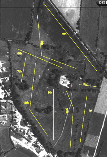
I had some lovely emails about my attempts to check my recollection of the layout of the first golf course I’d ever played, including one from Pat Moran who suggested that I might find on the Ordnance Survey of Ireland site a map of Mounthawk before the site was ‘developed’ . He was right: the 1995 aerial photograph shows the park after the club had moved to Barrow but before the JCBs had moved in. My annotated version of the 1995 image looks like this.
It’s an interesting image which shows much more detail than the more recent Google one. For example, the bunkers guarding the 2nd green are clearly visible.
And Andrew Laird asked how could I possibly have missed that delicious film, Pitch ‘n’ Putt with Joyce ‘n’ Beckett.
For which reminder, many thanks.

